One of the most enigmatic places on Earth… the Nazca lines!
These mysterious lines can be only seen from air, and they were first spotted in 1927 when Airlines started flying over Peru. Passengers immediately noticed strange lines, figures, and shapes far below on the ground. The Nazca lines, located in Nazca Peru have captured the imagination of historians, researchers, and tourists for decades!
These bizarre lines include more than 800 straight lines, 300 geometric figures and 70 animal (also called biomorphs) and plant designs at Nazca. If you plot the Nazca lines over the entire planet they intersect at one particular spot, and I can’t believe where they all meet!
No one can say for certain what their meaning is, why they were created, who exactly created them, and why they are only visible from the air, but that’s exactly why it makes them unique.
Geologists believe that these long series of geoglyphs were made by Nazca people in the ancient era between 400 and 600 AD.
The ancient Nazca culture belonged to an ancient prehistoric civilization that was successful in engineering techniques to bring underground water to the surface for irrigation purposes.
The longest glyph at Nazca is around 9 miles long.

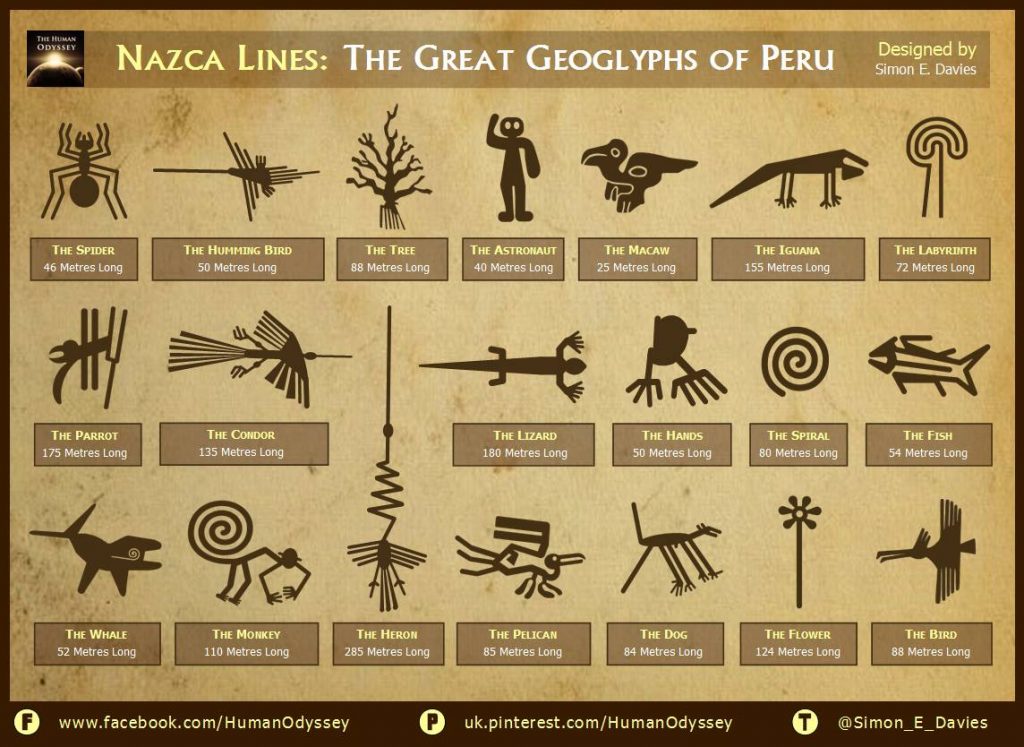
Nazca lines, courtesy Simon E. Davies.
Nazca legends suggest that Viracocha, the Inca creator god commissioned the Nazca lines thousands of years ago.
Live Science reports:
“One idea is that they are linked to the heavens with some of the lines representing constellations in the night sky. Another idea is that the lines play a role in pilgrimage, with one walking across them to reach a sacred place such as Cahuachi and its adobe pyramids. Yet another idea is that the lines are connected with water, something vital to life yet hard to get in the desert, and may have played a part in water-based rituals.
In the absence of a firm archaeological conclusion a number of fringe theories have popped up, such as the idea that the Nazca people used balloons to observe the lines from up high, something which there is no archaeological evidence for.”
One YouTube user did just that and the results according to many are staggering.
Why? because if you plot the lines—using Google Earth—over the entire globe they converge at one specific point: Angkor Wat, a temple complex located in Cambodia and one of the largest religious monuments on the planet measuring a staggering 162.6 hectares.
Here’s the video:
Now while some may find this extremely interesting, that Nazca lines up on the other side of Earth with Angkor Wat, the truth is that the Cambodian temple is the exact antipodal of Nazca.
An antipodal point on the surface of a sphere is the point which is diametrically opposite to it—so situated that a line drawn from the one to the other passes through the center of the sphere and forms a true diameter. As it turns out, antipodes of any place on the Earth is the point on the Earth’s surface which is diametrically opposite to it.
(Check out antipodesmap.com for interesting facts)
While it certainly is interesting that Nazca and Angkor Wat are “connected” at least via an antipodal point, maybe it’s just a coincidence, since all directions leading out of a single point, always converge at the antipodal point on the opposite side of a sphere.
I can’t stop to ponder whether it is a coincidence that an ancient sites antipodal point is another ancient site…
What do you guys think about this? Is there a connection?
This article was inspired by an incredible writing by Ivan and published on Ancient-Code
