California is in the middle of its fifth year in drought. Experts say it has been the worst the state has seen in 1,200 years.
Dwindling reservoirs, shrinking lakes, and dried-up farm fields dot the state’s landscape — and despite some recent signs of recovery, the overall outlook is still ominously dry.
Across the state, reservoirs remain far below their capacity and, more importantly, far below their historical average.
And California isn’t alone. Last year, Dean Farrell of the University of North Carolina at Chapel Hill made a stunning interactive graphic showing the shrinking state of reservoirs across the western US. Still, California stands out, with its reservoirs at roughly 46% of their total capacity.
These images, taken by the US Geological Survey and NASA Landsat 7 and 8 satellites and collected by the online lake reference site Lakepedia, show what 10 California reservoirs looked like in September or October 2001 (“before”) and what each reservoir looked like in the same month of 2016 (“after”).
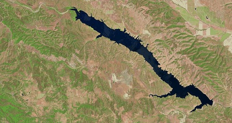
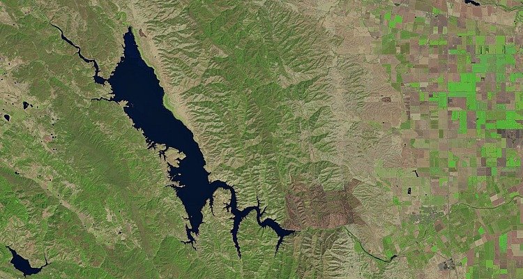
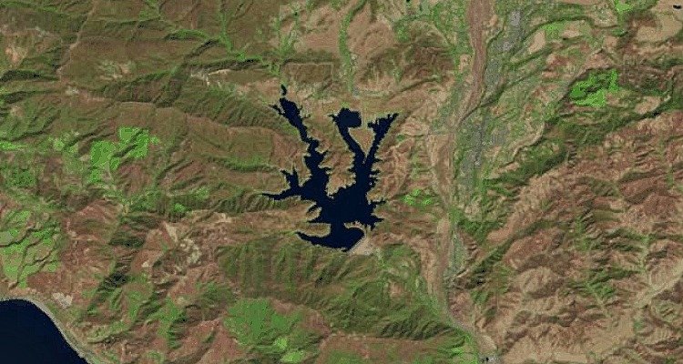
Lake San Antonio: Before (September 2001)
Lake San Antonio: After (September 2016)
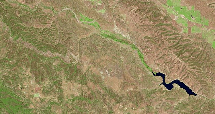
Together with Lake Nacimiento, Lake San Antonio is key to recharging the aquifers that provide water to Southern Monterey County.
In January, Lake San Antonio sat at just 3% of capacity, according to The Monterey Herald. Engineers call reservoirs that are this decimated “dead pools” because gravity can’t draw any water from them at such low quantities.
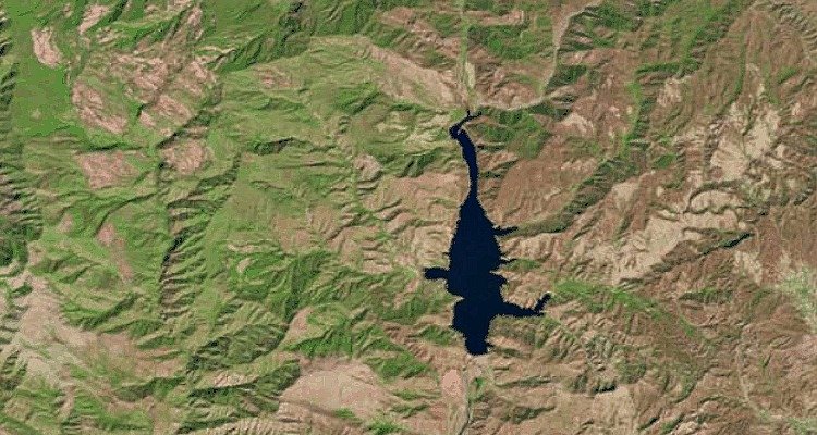
Lake Cachuma: Before

Lake Cachuma: After
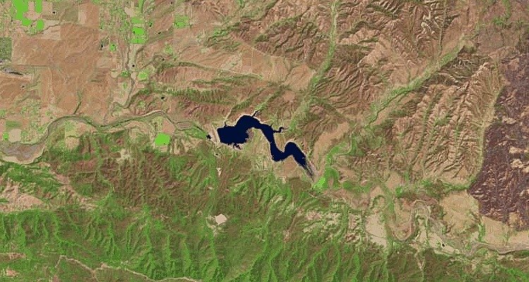
In May, Lake Cachuma, which serves the five water districts of Santa Barbara, Goleta, Carpinteria, Montecito, and Santa Ynez, was at 28,000 acre-feet, just 14% of its total capacity.
“Farther points out are just so dry,” Carpinteria resident Pat Saragosa told local news station KSBY 6. “It’s just really sad to see it all dry where it used to be a lot of water.”
San Luis Reservoir: Before
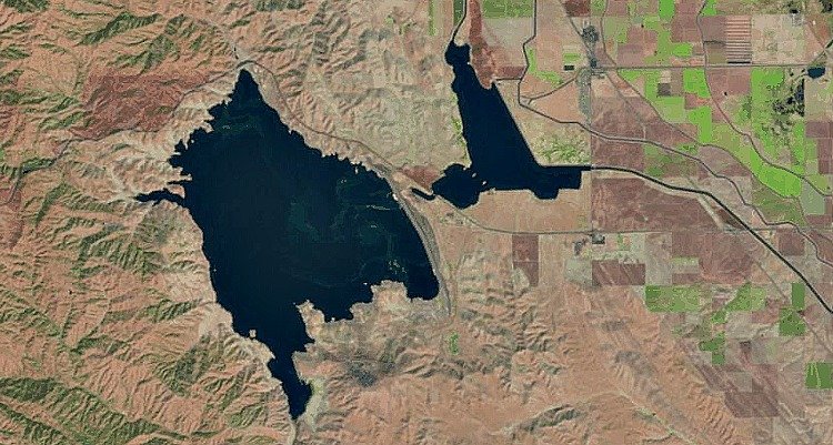
San Luis Reservoir: After
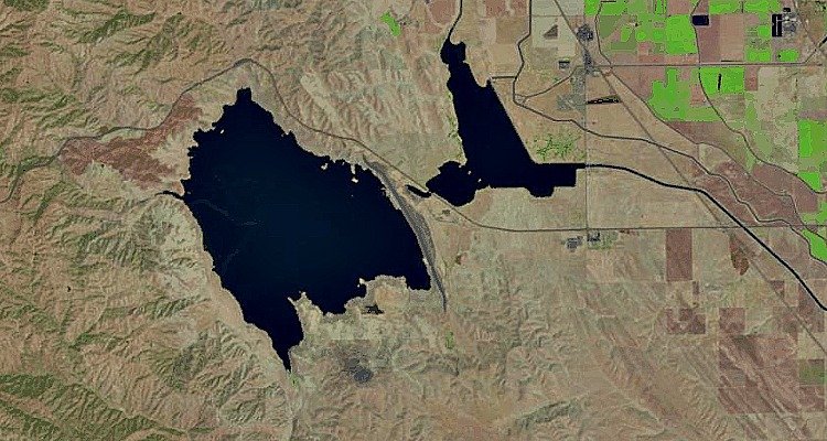
The San Luis Reservoir is located near Los Banos in the San Joaquin Valley. In August, San Luis was at its lowest level in a quarter century, according to local news station ABC 30.
“It’s a major concern … for every water user, whether you are a farmer or a city manager or resident of a community,” Johnny Amaral of the Westlands Water District told ABC 30 this summer.
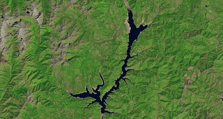
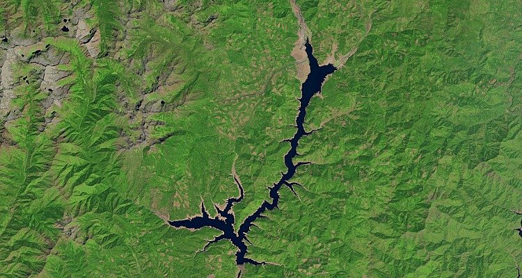
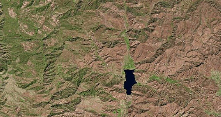
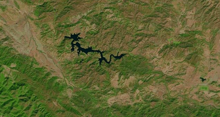
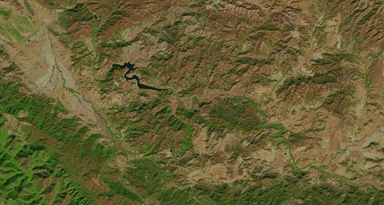
New Melones Lake: Before
New Melones Lake: After
Snaking through the central Sierra Nevada foothills, the New Melones Lake provides water for irrigation, hydroelectric power, and wildlife habitat. And supplies are not looking good.
The reservoir currently measures in at 21% of its total capacity, a figure that’s just 38% of its typical quantity for this season, according to data from the California Department of Water Resources.
Lake Berryessa: Before
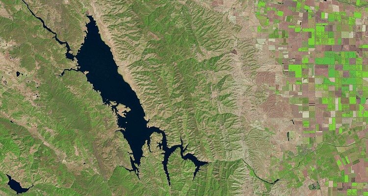
Lake Berryessa: After
At 1.6 million acre-feet, Lake Berryessa is the largest lake in Napa County. It’s currently just above half its capacity.
“We’re not where we’d like to be, but we’re in much better shape than some areas of the San Joaquin Valley,” Roland Sanford, a general manager for the Solano County Water Agency, told The Napa Valley Register in February.
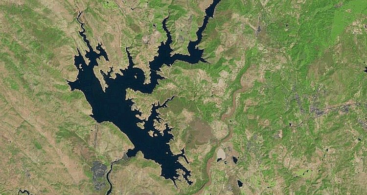
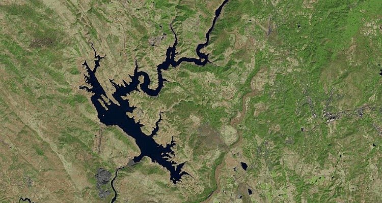
Trinity Lake: Before
Trinity Lake: After
In order to divert water from Trinity River to California’s thirsty Central Valley, engineers built Trinity Dam in 1958, and Trinity Lake was born.
Today, the lake is at 42% of its total capacity, 66% of its historical average for this time period.
Lake Casitas: Before
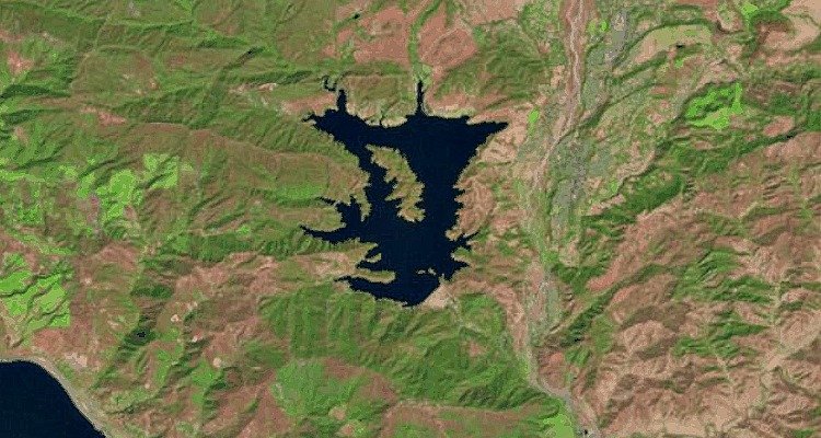
Lake Casitas: After
The water levels of Lake Casitas, a human-made lake in the Los Padres National Forest of Ventura County, dipped to historic lows in January.
“The lake is about 42% full,” Ron Merckling of the Casitas Municipal Water District told local news station KEYT3 that month. He said that was “the lowest it has been since about 1967.”
Now it’s just 36% full, according to the Casitas Municipal Water District.
Lake Piru: Before
Lake Piru: After
If Lake Piru were a lizard, half its body would be missing. While it looks nearly half full, the reality is more stark: It’s at 25% capacity.
Lake Perris: Before
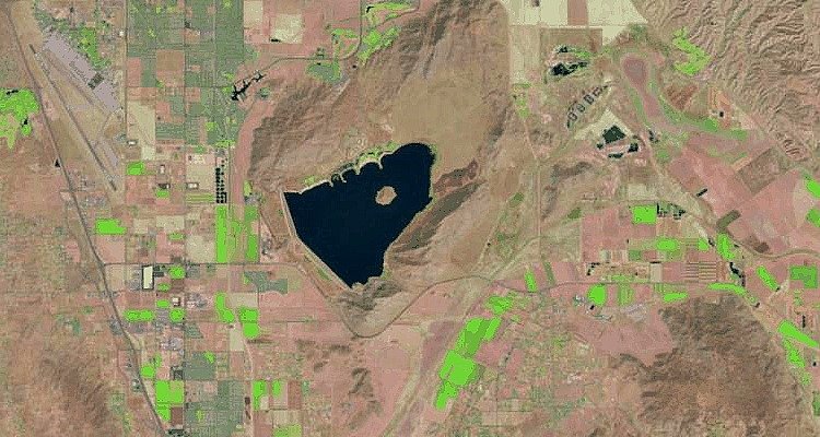
Lake Perris: After
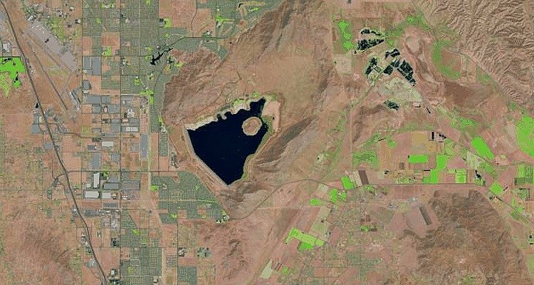
Southern California’s Lake Perris is currently at 37% of its total capacity, less than half of its historical average for this time period, according to the California Department of Water Resources.
Located in Riverside County, Lake Perris is 1,560 feet (480 meters) above sea level and surrounded by small hills.
Santa Margarita Lake: Before
Santa Margarita Lake: After
From this satellite image, Santa Margarita seems virtually dried up. And it’s almost there: According to San Luis Obispo County Water Resources, the lake is currently at less than 10% capacity.
Hopefully, Santa Margarita — along with the rest of California — will get some much-needed rain soon.
Read also: “Earth Has Shifted”- Inuit Elders Issue Grave Warning To NASA And The World [VIDEO]
Sources: Lakepedia; San Luis Obispo County Water Resources Santa Margarita Report 2016
Originally published on Business Insider